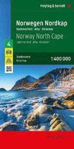
Norwegen Nordkap, Straßenkarte 1:400.000, freytag & berndt
This detailed road map of Norway North Cape is very suitable for planning and traveling around the country. The road network is well represented, both the main roads, provincial and local roads. Road numbers are also clearly stated. Distances betw...

Iceland, road map 1:400,000, freytag & berndt, softcover
The 1:400,000 scale road and leisure map of Iceland provides a wealth of useful information for travelers wishing to experience the breathtaking beauty of Iceland. With the road map from freytag & berndt , drivers and motorcyclists can exp...

Samos, Wander- und Freizeitkarte 1:35.000, freytag & berndt
The Samos hiking and leisure map provides detailed information about the hiking trails on Samos. With the map you can ideally plan your tours and find out about the sights along the route. Samos offers hikers a fascinating and varied backdrop. Hig...

Gran Canaria, road and leisure map 1:50,000, freytag & berndt
The road and leisure map of Gran Canaria at a scale of 1:50,000 contains a lot of information that is useful and helpful for a trip to the largest of the Canary Islands. The branched road network is shown exactly, scenic roads are highlighted in c...

Dachstein, hiking, cycling and leisure map 1:50,000, freytag & berndt, WK 0281
Thanks to the detailed digital cartography and the precise scales, freytag & berndt hiking maps are ideal companions for hiking and cycling. They are revised regularly and contain updated information on hiking trails, cycling and mountain biki...
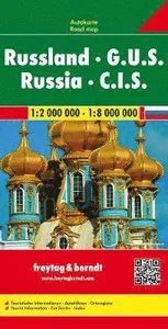
Russia - CIS Road Map 1:2 000 000 - 1:8 000 000
This recto / verso detailed road map of Russia / Eastern Europe is very suitable for planning and traveling around the country. The road network is well represented, both the main roads, provincial and local roads. Road numbers are also clearly st...
Salzkammergut Wanderatlas
Salzkammergut Wanderatlas

Romania - Moldova Road Map 1:500 000
This detailed recto/verso road map of Romania - Moldavia is very suitable for planning and traveling around the country. The road network is well represented, both the main roads, provincial and local roads. Road numbers are also clearly stated. D...
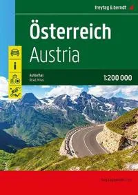
Austria Road Atlas 1:200,000
In addition to the clear design, the practical car atlas Austria 1:200,000 offers a lot of additional information such as sights, campsites and numerous city maps. Motorists and motorcyclists will appreciate the precise cartography from freytagberndt, especially for on-site planning and orientation.

Europe Map Flat in a Tube 1:3 500 000
freytagberndt maps are available for many countries and regions in the world. In addition to the precise cartography each map also includes a lot of additional information about the region covered.

Innsbruck CP
Innsbruck CP

Italy South Road Map
The 1:500,000 scale road map of Southern Italy contains all the essential information for travelers visiting Southern Italy by car, motorcycle, or caravan. The comprehensive road network is precisely depicted, tourist routes are color-coded, and many tourist attractions are marked on the map.

Spain North - Way of St. James Road Map 1:400 000
freytagberndt maps are available for many countries and regions in the world. In addition to the precise cartography each map also includes a lot of additional information about the region covered.

Norway Road Atlas
The Norway road atlas 1:250,000 - 1:400,000 is the ideal companion for anyone who is travelling by car in Norway and does not want to just use the main roads. It is ideal for planning and also proves to be an indispensable guide during the trip. T...

Algarve Road Map 1:150 000
This detailed road map of Algarve is very suitable for planning and traveling around the country. The road network is well represented, both the main roads, provincial and local roads. Road numbers are also clearly stated. Distances between places are marked on the map in kilometers, and gas stations are also marked in important places. Shadow shows the relief and sometimes some points with the actual height. Province borders, national parks and reserves are easy to find. Symbols indicate the location of tourist sites, monuments, historically important places and viewpoints. In certain places you can find hotels and campsites, airports, train connections and ports.
Belgium
Belgium

Kenya Road Map 1:1 000 000
freytagberndt maps are available for many countries and regions in the world. In addition to the precise cartography each map also includes a lot of additional information about the region covered.

Lake Garda Road Map 1:50 000
freytagberndt maps are available for many countries and regions in the world. In addition to the precise cartography each map also includes a lot of additional information about the region covered.

Zillertal Alps, hiking, cycling and leisure map
The region around Mayrhofen, Gerlos, Krimml and Tuxertal offers countless opportunities for outdoor activities, especially for hikers and cyclists.
Costa Vicentina Hiking and Leisure Map 1:50,000
The 'Costa Vicentina' hiking map set shows the most famous Portuguese long-distance hiking trail on a scale of 1:50,000

Kefalonia
Kefalonia

Majorca
n addition to the clear design, the street and leisure map Mallorca 1:50,000 shows a lot of additional information such as sights, long-distance hiking trails and campsites. The comprehensive register of places enables quick orientation. - Mallorca 1:50,000 - info guide - city map of Palma - location register with GPS - long-distance hiking trails

Norway Middle Road and Leisure Map
In addition to the clear design, the road map Norway - Central (Trondheim - Lillehammer - Alesund) 1:250,000 offers a lot of additional information such as road conditions, sights, campsites.

Italy Road Atlas (1:150,000)
In addition to the clear design, the large road atlas of Italy has a lot of additional information such as road conditions, sights and various city maps. An extra chapter also deals with all campsites and parking spaces in Italy.

Sardinia - Cagliari, Roadmap 1:150.000
The road and leisure map of Sardinia at a scale of 1:150,000 contains lots of useful information for a holiday on the Mediterranean island. The dense road network is mapped exactly, scenic roads are highlighted in color and many destinations are marked on the map.

Slovenia
The road and leisure map of Slovenia at a scale of 1:150,000 contains a lot of useful information for a holiday in Slovenia.
Peloponnes Road and Leisure Map 1:150,000
The Peloponnese road and leisure map at a scale of 1:150,000 contains a lot of information that is useful and helpful for a trip to the Greek peninsula. The branched road network is shown exactly, scenic roads are highlighted in color and many destinations are marked on the map.

Crete Road and Leisure Map 1:150,000
In addition to the clear design, the road map of Crete 1:150,000 offers a lot of additional information such as sights, campsites and a map of the city centre. The comprehensive register of places enables quick orientation.

Croatia Road Map 1:500,000
In addition to the clear design, the road map 'Croatia 1:500,000' offers a lot of additional information such as sights, campsites and city centre maps.

Friuli-Venezia Giulia, road and leisure map 1:150,000, freytagberndt
The Friuli-Venezia Giulia road and leisure map at a scale of 1:150,000 contains a lot of useful information for a trip to the picturesque northern Italian region.

Northern Europe - Scandinavia, Baltic countries road map 1:2
In addition to the clear design, the road map 'Northern Europe - Scandinavia 1:2,000,000' has additional information such as street conditions and various city center maps.

Sicily East and West Pack
freytagberndt car cards are available for many countries and regions worldwide. In addition to the clear design, the street maps have a lot of additional information such as street conditions, sights, campsites and various city center maps.

Namibia, road map 1:1,000,000, freytagberndt
The freytagberndt road map of Namibia at a scale of 1:1,000,000 is an indispensable tool for anyone who wants to explore the country on their own. The car map shows all important roads, slopes and tracks, cities and sights as well as scenic highlights.

Northern Italy, road map 1:500,000, freytagberndt
The road map north of Italy at a scale of 1:500,000 contains a lot of information that is useful and helpful for a trip to the north of Italy. The branched road network is shown exactly, scenic roads are highlighted in color and many interesting destinations are marked on the map.

Apulia : Bari, Brindisi, Taranto
In addition to the clear design, the Apulia road and leisure map offers a lot of additional information such as sights, campsites and scenic routes.
Balkans - Europe Southeast Europe Road Map
In addition to the clear layout, the 'Balkans - Southeastern Europe 1:2,000,000' road map has a great deal of additional information such as road conditions, world heritage sites, nature reserves and city center maps of all state capitals.

Slovenia
The Slovenia 1:200,000 road map offers a lot of additional information such as road conditions, sights and campsites.

Rome City Pocket Map
The Rome city map 1:10,000 offers a lot of additional information such as a subway map, public transport and sights. You can also find every address in the extensive index. All content is of course updated regularly. The titles in the â??City Pocketâ? series fit in every pocket thanks to their handy format of 9 x 15 cm.
Thailand Road Map
In addition to the clear design, the Thailand road map, 1:900,000 has a lot of additional information such as road conditions, sights, campsites and a city center map.

Lanzarote Road and Leisure Map
This detailed road map of Lanzarote is very suitable for planning and traveling around the country. The road network is well represented, both the main roads, provincial and local roads. Road numbers are also clearly stated. Distances between places are marked on the map in kilometers, and gas stations are also marked in important places. Shadow shows the relief and sometimes some points with the actual height. Province borders, national parks and reserves are easy to find. Symbols indicate the location of tourist sites, monuments, historically important places and viewpoints. In certain places you can find hotels and campsites, airports, train connections and ports.