
2025 Philip's Easy to Read Multiscale Road Atlas Europe
PHILIP'S: THE BEST-SELLING EUROPEAN ATLAS RANGE IN THE UK With the detail you need at a size you can read, the 2025 Philip's Easy to Read Multiscale Road Atlas of Europe is the ultimate driving companion. Featuring: * Super-clear main scale at 1:7...
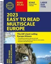
2023 Philip's Easy to Read Multiscale Road Atlas Europe
PHILIP'S: THE MOST TRUSTED EUROPE ROAD ATLAS RANGE IN THE UK Perfect for driving in Europe, and including all the key driving regulations for each country, this Road Atlas is a practical, easy-to-read A4 size with lie-flat spiral binding....
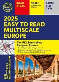
2025 Philip's Easy to Read Multiscale Road Atlas of Europe
PHILIP'S: THE BEST-SELLING EUROPEAN ATLAS RANGE IN THE UK With the detail you need at a size you can read, the latest 2025 Philip's Easy to Read Multiscale Road Atlas of Europe is the ultimate driving companion. Including the rules and regulations across Europe for easy driving, and the high speed network if you need to take to the train. * Super-clear main scale at 1:750,000 (12 miles to 1 inch) * Multiscale mapping with scales from 1:200,000 to 1:3M, showing more detail where you need it * Clear mapping of every country in Europe and the driving rules and regulations * Distance Chart and a 23-page route planning section included, for easy route planning across long distances * Spectacular scenic routes clearly highlighted * Including a handy map of Europe's High-Speed Rail Network to help plan long distance journeys with ease * A4 format with sturdy flaps 'The clearest and most detailed maps of Europe' David Williams MBE, former CEO Gem Motoring Assist 'The best of its kind with
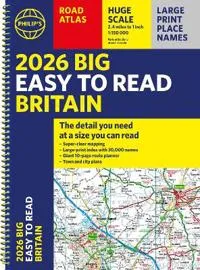
2026 Philip's Big Easy to Read Britain Road Atlas
'The detail you need at a size you can read'. The latest 2026 Philip's Easy to Read Road Atlas of Britain from the best-selling Road Atlas range has exceptionally clear mapping and everything you need for exploring Britain. With a special lie-flat spiral binding, it will enhance any trip. · Large maps packed with extra details for a better journey · Huge 1:150,000 scale (approx 2.4 miles to 1 inch) · Large print place names · Large print index · 88 detailed town plans for easy navigation · Expanded London ULEZ clearly shown on approach mapping · Super-clear 10-page route planner to create the best journeys · Thousands of attractions clearly mapped, including castles, theme parks, gardens, zoos and more · Over 100,000 copies of the Philip's Easy Read Road Atlases of Britain sold since launch in 2020. At last, a road atlas that everyone can read easily, in or out of the car, no matter what the conditions. With up-to-date mapping technology, your travels have never been easier to plan.
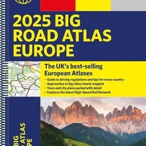
2025 Philip's Big Road Atlas of Europe
PHILIP'S: THE BEST-SELLING EUROPEAN ATLAS RANGE IN THE UK with 'The clearest and most detailed maps of Europe' David Williams MBE, former CEO Gem Motoring Assist 'The best of its kind with quick, easy-to-use information' Fleet Week * Super-clear m...
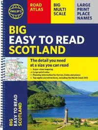
Philip's Big Easy to Read Scotland Road Atlas (Spiral A3)
Philip's Big Easy Read Scotland Road Atlas is an exceptionally clear guide to the best of Scotland from the market-leading map makers. Reliable and up to date, the fully indexed mapping is accompanied by town plans, tourist and planning information, and spectacular scenic routes including the celebrated North Coast 500. The detailed yet easy-read maps show national parks, cultural and historical attractions, long-distance footpaths and much, much more. · Exceptional clarity with large-print place names and large-scale maps · Large-print index · Super-sized A3 pages for easy reading on the go · Shows most of Scotland at a scale of 1 inch to 2.37 miles (1:150 000); most islands and north Scotland at 1 inch to 3.16 miles (1:200 000) and 1 inch to 3.95 miles (1:250 000) · Packed with ideas and details about places to visit · Easy to read mapping with the NC500, long-distance footpaths, national parks, museums, castles and more · Town centre maps, fully indexed for easy navigation · Clear

Philip's Big Easy to Read France, Spain & Portugal Road Atlas
The Philip's Big Easy to Read France, Spain and Portugal Road Atlas, in a large spiral bound lie-flat edition, is the must-have travelling atlas for anyone who needs the big picture for touring these countries and the adjacent countries including ...

Collins 2026 Big Road Atlas Europe
With fully-updated, large-scale mapping, there has never been an easier way to explore Europe by road. This super-clear, detailed road mapping covers all the top European tourist destinations in a large, easy-to-read format. Bask on the French Riviera, relax in sunny Sicily or discover the Dalmatian Coast; plot any of these trips with this comprehensive and accessible A3, spiral-bound atlas. With main mapping at a scale of 12 miles to the inch, this Road Atlas of Europe is our clearest yet. Main features * 116 super-size main mapping pages * 12 additional pages of route planning mapping for long distances * Accessible, large print font * Clarifies toll and toll free motorways for ease of use * Scenic routes identified and highlighted * Easy-to-use, large A3 size with handy spiral binding * Full road classification * Local town and city names match up with local road signs to aid navigation * Legible and easy to read index * Major European routes shown Coverage of the whole of Europe
Philip's Europe Road Map
For all your holiday and travel needs, the latest up-to-date edition of Philip's super-clear map of Europe. 'The Clearest and Most Detailed Maps of Europe' David Williams MBE, former CEO Gem Motoring Assist The perfect a...

Philip's Europe Road Map
For all your holiday and travel needs, the latest up-to-date edition of Philip's super-clear map of Europe. 'The Clearest and Most Detailed Maps of Europe' David Williams MBE, former CEO Gem Motoring Assist The perfect all-inclusive map for planni...

2023 Philip's Road Atlas Britain and Ireland
PHILIP'S - No. 1 in the UK for clear maps 'Good balance between detail and clarity with excellent town maps' What Car? * Mapping at a scale of 3 miles to 1 inch = 1:200,000 * Philip's: Market leader and Britain&...

Collins Essential Road Atlas Europe
Discover new places with handy road atlases from Collins. Up-to-date A4 paperback road atlas of Europe. Contains clear, large-scale, detailed road mapping, perfect for touring the Mediterranean, Iberian peninsula, Scandinavia and all European tour...
Southern Balcans - Bosnia and Herzegovina, Serbia, Montenegro, Kosovo, Macedonia, Albania, Greece, Bulgaria, Romania, Moldova Road Atlas 1:200 000 - 1:500 000
This road atlas is easy to read. With many symbols information is given from, among other things, campsites, ferry services and (youth) hostels. The road network is well represented, both the main roads, provincial and local roads. Road numbers ar...

Sweden Road Atlas 1:400 000
This road atlas is easy to read. With many symbols information is given from, among other things, campsites, ferry services and (youth) hostels. The road network is well represented, both the main roads, provincial and local roads. Road numbers ar...
Road to Social Europe
In the wake of the Greek and Irish crises, and at a moment when solidarity between states is hotly debated on a daily basis at EU level, it is important to understand how 'solidarity' can happen at all. The Road to Social Europe reviews the develo...


Philip's France and Spain Road Atlas
The latest edition of Philip's France and Spain Road Atlas, in a handy spiral A4 format, is the must-have atlas for anyone travelling or driving in these and the adjacent countries including Belgium, Luxembourg and Portugal. From the market leader...

Norway Road Atlas
The Norway road atlas 1:250,000 - 1:400,000 is the ideal companion for anyone who is travelling by car in Norway and does not want to just use the main roads. It is ideal for planning and also proves to be an indispensable guide during the trip. T...

Road Atlas Ireland
Explore Ireland with this accurate and fully updated road atlas. This road atlas is at A4 size, covering the whole of Ireland and features clear and detailed Collins colour mapping at a scale of 5.2 miles to 1 inch. Perfect for both residents and ...

Scandinavia Road Atlas
The Road Atlas Scandinavia 1:200,000 - 400,000 is the right companion for all holidaymakers who are traveling by car in the far north and also want to get to know the area to the left and right of the motorway. It is ideal for planning and also pr...

AA Easy Read Atlas Britain 2025
This A4 format atlas provides giant scale mapping and type throughout making it very easy to use. Each page has been titled with its geographical location so you can turn to the page you need more easily. Wide minor roads (more than and less than 4m wide), National Trust, English and World Heritage sites, crematorium locations and other hard-to-find places are indicated on the mapping. There is also a full-colour admin map showing all the latest unitary authority areas and a 6 page route-planning map.
AA Traveller's Atlas France 2025
This specialist easy-to-read A4 road atlas is designed for the British motorist in France. Coverage includes 28 city centre plans to help you find your way in and around busy centres. The road mapping clearly shows places of interest and important...

To Read Or Not To Read
Keep track of the books you read, record thoughts on your favorite books, get inspired for your next read, and reflect on your literary spiritual journey with this beautifully designed journal for readers. The perfect addition to any personal library, To Read or Not to Read encourages readers of all genres to immerse themselves in a classically illustrated reading journal complete with DIY book review pages and inspirational reading lists. To Read or Not to Read allows readers to step into the book critic role and determine which books to recommend, and which ones to skip based on their reflections throughout the journal. It includes a "How Bookish Are You?" quiz and spotlights on authors such as Flannery O'Connor and Frederick Douglass, whose published works have greatly influenced the combined spheres of faith and literature. With additional fun facts and helpful conversation starters for literary discussions, this journal will become the signature accessory at book clubs, on nightstands, and on every book lover's shelf.

Road to Jerusalem: Road to Jerusalem
Per Møller Jensen (The Haunted), Michael Skovbakke (Konkhra), Andreas Holma (Hypocrisy, Soilwork) och Josh Tyree är Road To Jerusalem. Albumet är mixat av den kritikerrosade producenten Tue Madsen (Rob Halford, Meshuggah). För fans av Pearl Jam, Led Zeppelin, Rival Sons.

Road To Jerusalem: Road To Jerusalem
Road To Jerusalem: Road To Jerusalem [Gatefold / Vinyl LP]

Oxford International Primary Atlas
This new edition of the Oxford International Primary Atlas is clear, bright and informative. It includes up-to-date country data, easy-to-read colourful mapping, and worldwide topographic content, including areas such as Europe, Malta, Cyprus, Mid...

Western Balkans Road Atlas
The Western Balkans road atlas 1:150,000 is the ideal companion for anyone who travels by car and does not want to use only the main roads and motorways. It is ideal for planning and also proves to be an indispensable orientation aid during the trip.

Road Atlas - Adventure Edition
National Geographic's Adventure Road Atlas is a rugged, 168-page road atlas that provides detailed maps of all 50 states, as well as Canada and Mexico. It features a tough, clear plastic cover and spiral binding to prevent wear and tear. The atlas...

Official Road Atlas Ireland
This edition contains updated road maps covering Ireland, plus City and Town Maps and Motoring Information, Distance Charts and Extensive Gazetteer (Index of Towns). This new 8th edition is published in conjunction with Ordnance Survey Northern Ir...

Alaska Road & Recreation Atlas
Alaska truly is the Last Frontier. No other publication can display this rugged scenery and recreation potential with more precision than Benchmark's Alaska Road & Recreation Atlas. The Landscape Maps reveal landforms with amazing realism and ...

Philip's Ireland Road Map
All of Ireland is clearly shown in this handy, up-to-date Philip's road map covering the whole island at 9 miles to 1 inch. By including the latest new roads and motorways, route-planning and touring is made wonderfully simple with this easy-to-re...
2026 Rand McNally Large Scale Road Atlas
2026 Rand McNally Large Scale Road Atlas

How to Read European Armor
An accessibly written and superbly illustrated introduction to armor used for battle, tournament, and ceremony This engaging book offers an introduction to and overview of armor in Europe from the Middle Ages through the 17th century, focusing in ...

Red road
Fjortonåriga Rosie lever fruktansvärt utsatt, hon bor på ett av Glasgows barnhem, är prostituerad och utnyttjas brutalt av sin hallick. Det som håller henne uppe är fantasierna om en kille som hon är hemligt förälskad i, och den lyckliga framtid s...

Red Road
Power, abuse, love gone horribly wrong - and a crime that stretches back two decades...From the two-time THEAKSTONS OLD PECULIER CRIME NOVEL OF THE YEAR AWARD-winning author.A girl who has seen more darkness than most.A Scottish lawyer waiting to ...

Red Road
Power, abuse, love gone horribly wrong - and a crime that stretches back two decades... From the two-time THEAKSTONS OLD PECULIER CRIME NOVEL OF THE YEAR AWARD-winning author. A girl who has seen more darkness than most. A Scottish lawyer waiting ...

Red Road
OBS! Import. Kontrollera att språk och textning passar dig.Cannes Prix du Jury-winning Scottish noir thriller about a Glasgow CCTV operator who ends up stalking a man she sees on screen. Andrea Arnold's first full-length feature after winning an Academy Award for her short film, 'Wasp', follows Jackie (Kate Dickie) a Glasgow CCTV control-room operator. One day, watching the monitors, she sees a man (Dickie Curran) she knows but is trying to forget and is soon helplessly outside her jurisdiction and brief, stalking the man, on camera, back to his flat. Eventually she crosses the line and goes to the address, meeting a young man (Martin Compston) whom, she finds out, lives there along with her subject.Typ: DVD

Red Road
OBS! Import. Kontrollera att språk och textning passar dig.Cannes Prix du Jury-winning Scottish noir thriller about a Glasgow CCTV operator who ends up stalking a man she sees on screen. Andrea Arnold's first full-length feature after winning an Academy Award for her short film, 'Wasp', follows Jackie (Kate Dickie) a Glasgow CCTV control-room operator. One day, watching the monitors, she sees a man (Dickie Curran) she knows but is trying to forget and is soon helplessly outside her jurisdiction and brief, stalking the man, on camera, back to his flat. Eventually she crosses the line and goes to the address, meeting a young man (Martin Compston) whom, she finds out, lives there along with her subject.Typ: Blu-ray

South East England A-Z Road Atlas
This A-Z map of South East England is a full colour regional road atlas featuring 46 pages of continuous road mapping extending from Banbury and Felixstowe to the south coast, and from Oxford and Southampton to Margate and Clacton-on-Sea in the ea...
Balkans - Europe Southeast Europe Road Map
In addition to the clear layout, the 'Balkans - Southeastern Europe 1:2,000,000' road map has a great deal of additional information such as road conditions, world heritage sites, nature reserves and city center maps of all state capitals.